Reaching IIT Bombay
IIT Bombay is located at Powai, which is an eastern suburb in the North-Eastern part of Mumbai. Mumbai is in the form of a long narrow island, almost a peninsula, thrusting south wards into the Arabian Sea. It can be broadly divided into four zones: South Bombay (Colaba, CST, Fort, Churchgate, Nariman Point etc.), Central Bombay (Dadar, Bombay Central, Worli etc.), Western suburbs (Bandra, Juhu, Andheri, Borivali etc.) ,and Eastern Suburbs (Kurla, Chembur, Ghatkopar, Mulund, Kanjur Marg, Vikhroli etc.). There is also New Bombay (Vashi, Turbhe etc.) across Thane Creek on the mainland.
Here is a map
of Mumbai, and this
is how it looks from a satellite. The dark areas indicate
the tree cover which is prominently visible in the area
representing the Aarey Colony and the Sanjay Gandhi National
Park, Borivali. Somewhere to the south of that dark patch, Powai
Lake (the smaller one) and the Vihar Lake (the bigger one) is
also visible. IIT Bombay is situated touching the two.
Here is a rail
map of Mumbai, and this
is a road map. You can use
m-Indicator to find your way in Mumbai.
Reaching my Office (CC306) or PLATO Lab
(CC210)
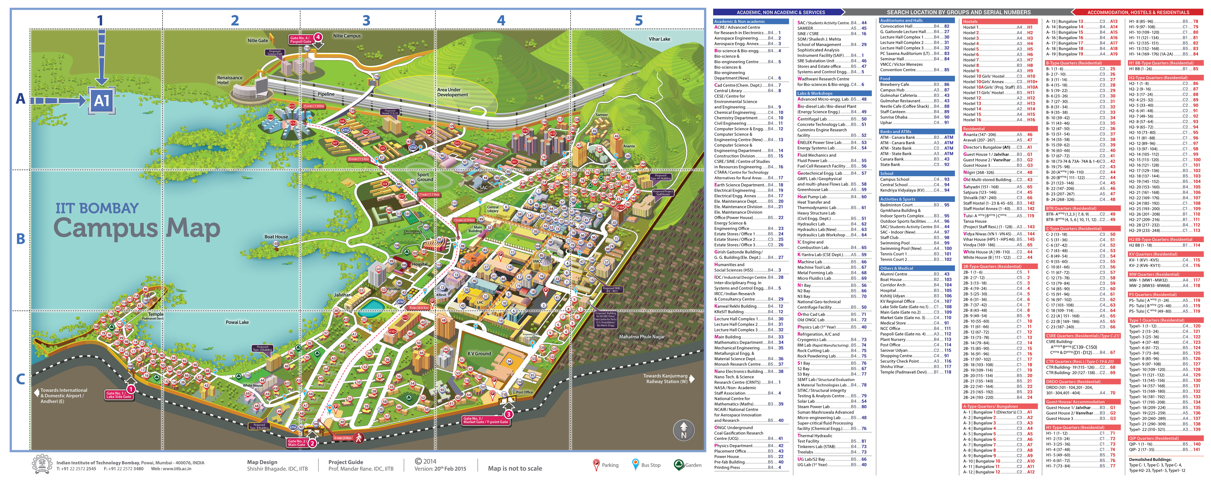
My office is CC306 on the third floor in
building (called the Computing Complex) which is building 13 in
cell B4 in this
map. I may also be found in the PLATO lab (CC210)
on the second floor in the same building.
In order to access the second and third
floors, you should take the south side lift towards the KR
building (building 12 in cell B4 in the map). The north side lift
towards SOM building (building 29 in the map) does not open in a
corridor connecting the rooms on the floor.
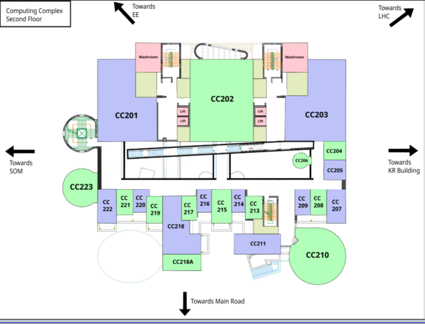
Use the floor plan of the second floor of
the building to reach the PLATO lab (CC210) and the floor plan
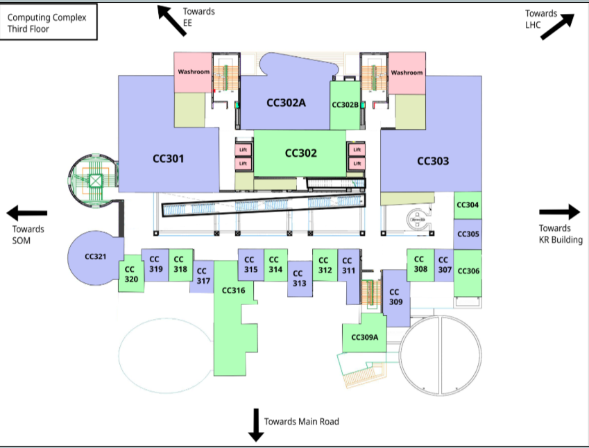
of the third floor of the building to
reach my office (CC306).