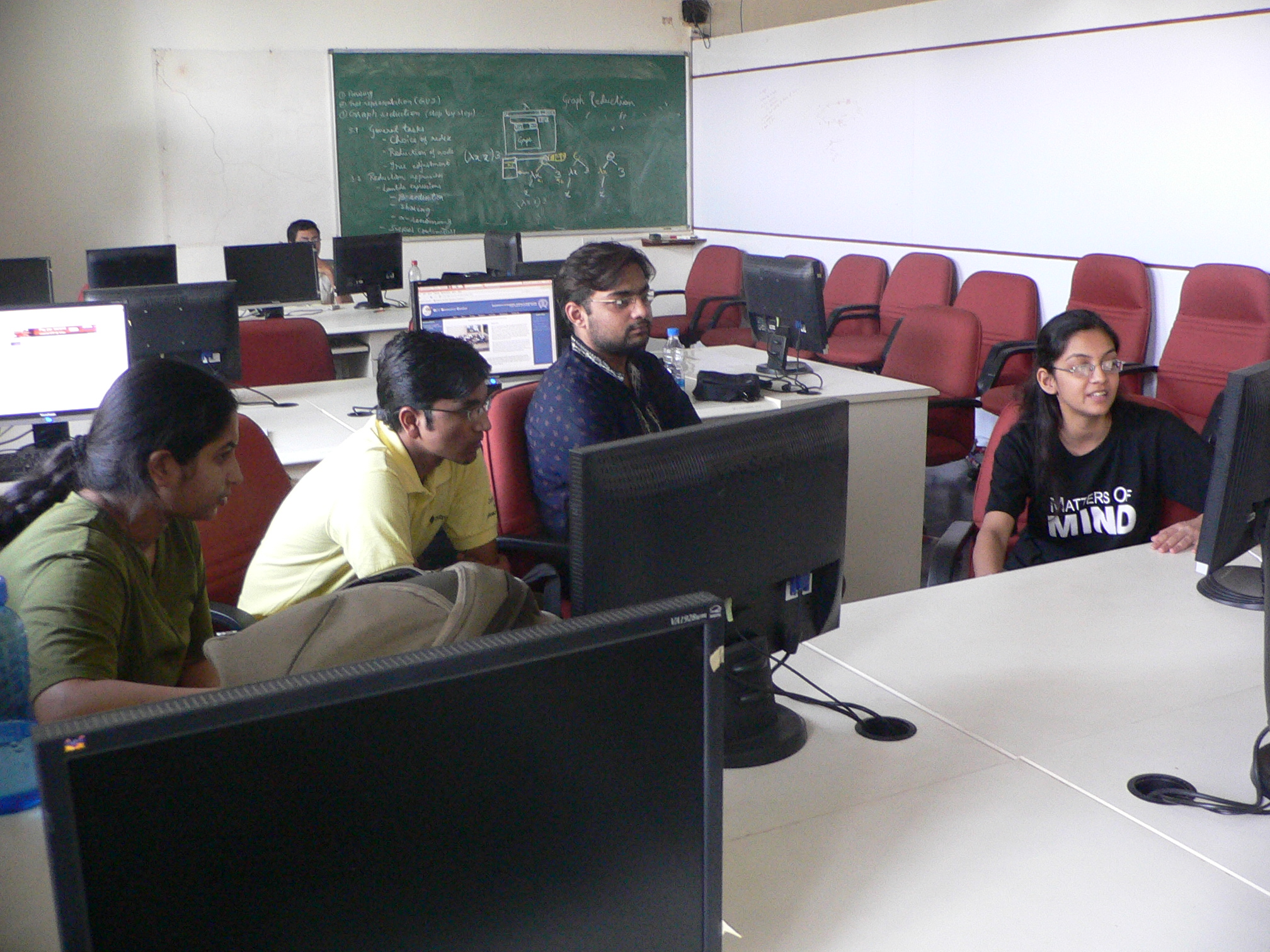
GCC Resource Center
How to Reach Us
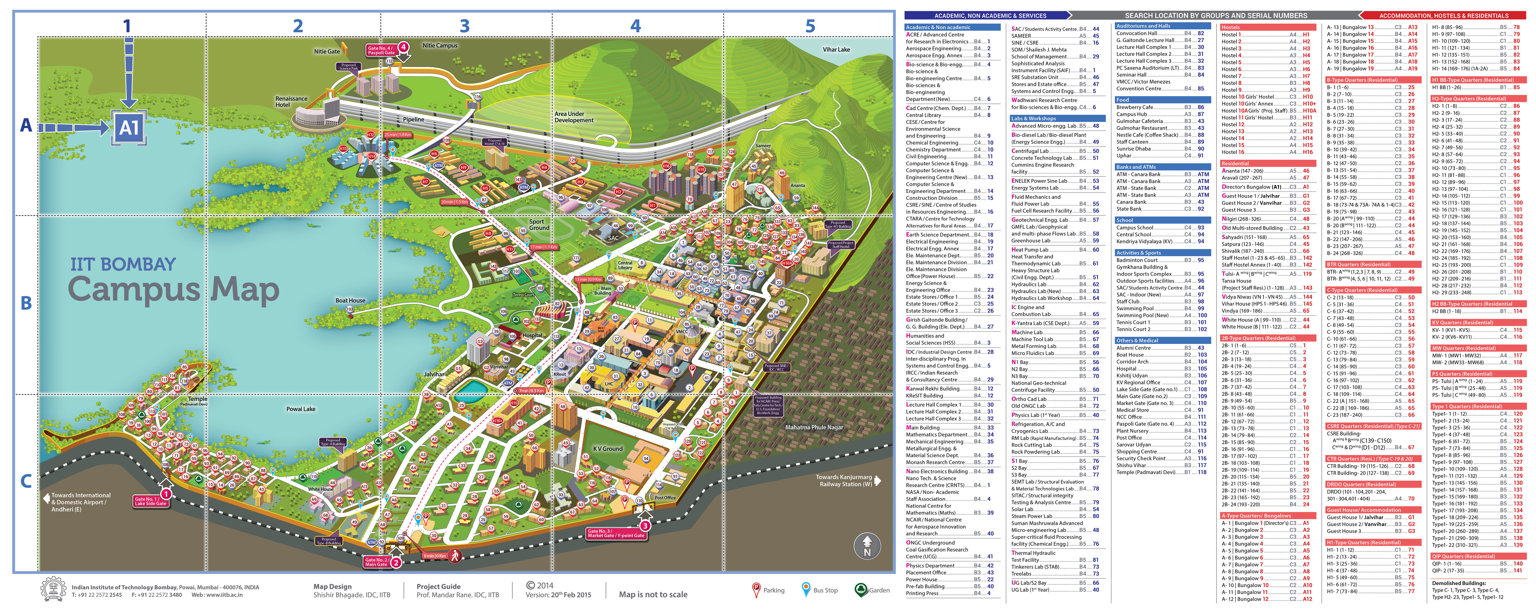
The GCC Resource Center is situated in 402 on the fourth floor of the New CSE building (marked number 13 in the IIT Bombay map). For travelling within IIT Bombay, you can use the internal transport facility. The bus coupons are available with the security at the Main Gate and the Y Point Gate/Market Gate.
Reaching IIT Bombay
IIT Bombay is located at Powai, which is an eastern suburb in the North-Eastern part of Mumbai. Mumbai is in the form of a long narrow island, almost a peninsula, thrusting south wards into the Arabian Sea. It can be broadly divided into four zones:
- South Bombay (Colaba, CST, Fort, Churchgate, Nariman Point etc.)
- Central Bombay (Dadar, Bombay Central, Worli etc.)
- The Western suburbs (Bandra, Juhu, Andheri, Borivali etc.)
- The Eastern Suburbs(Kurla, Chembur, Ghatkopar, Mulund, Kanjur Marg, Vikhroli etc.)
There is also New Bombay (Vashi, Turbhe etc.) across Thane Creek on the mainland.
Here is a map of Mumbai, and this is how it looks from a satellite. The dark areas indicate the tree cover which is prominently visible in the area representing the Aarey Colony and the Sanjay Gandhi National Park, Borivali. Somewhere to the south of that dark patch, Powai Lake (the smaller one) and the Vihar Lake (the bigger one) is also visible. IIT Bombay is situated touching the two.
Public Transport in Mumbai
Mumbai has one of the most efficient and reliable public transport networks. One can travel by Autorickshaws or Taxis to reach IIT from the nearest stations (Autorickshaws, however do not go further south than Sion and Bandra). For longer distances, one can use either the BEST Bus Network or the Mumbai Local train System. The approximate Bus/Autorickshaw/Taxi fares are given below.
| Name Of Place | Bus Numbers |
| Mulund(W) | 307, 346, 425, 396, 398, 460, 422, 424, 461 |
| Bhandup(W) | Same as above |
| Kanjur Marg(W) | Same as above |
| Vikhroli(W) | 392, 382, 337 |
| Ghatkopar(W) | 392, 382, 337 |
| Borivali(E) | 461, 398, L1 |
| Goregaon(E) | 460, 489, 424 |
| Jogeshwari(E) | 461, 445 |
| Andheri(E) | 396, 336, 392, 307 |
| Bandra(E) | 422, 424 |
| Kurla | ----- |
| Dadar | ----- |
| CST | ----- |
| Mumbai Central | ----- |
| Sahar Air Port | ----- |
| Santacruz | ----- |
Here is a rail map of Mumbai, and this is a road map. You can use Mumbai Navigator, developed at IIT Bombay, to find your way in Mumbai (use firefox of mozilla to browse the navigator).
Suburban Railway Transport
Those taking the Central Railway Suburban train will have to get down at Kanjur Marg, Vikhroli or Ghatkopar which are the nearest stations from IITB and those coming by the Western Railway Suburban train will have to get down at Andheri, Bandra, Goregaon or Malad. Stations for Through Trains Coming to Mumbai are :
- Central Railway: CST, Dadar, Kurla, Thane.
- Western Railway: Mumbai Central, Dadar, Bandra, Andheri, Borivali, Kurla.
There is a terminus at Kurla where some Central as well as Western Railway Trains terminate. There is no convenient bus route from Kurla terminus. Taking an autorickshaw is the best option. However it would be more economical to take a suburban train from Kurla to Kanjur Marg and then take an autorickshaw.
AirPort
International flights land at Sahar Airport which is about 7 kms from IIT. The Domestic Airport at Santacruz is about 10 kms. Pre paid taxis are available at the airports. Autorickshaws are also available for IIT.
Tested on Firefox version 3.0.8 and above | Site designed and maintained by GRC | © 2013, GCC Resource Center