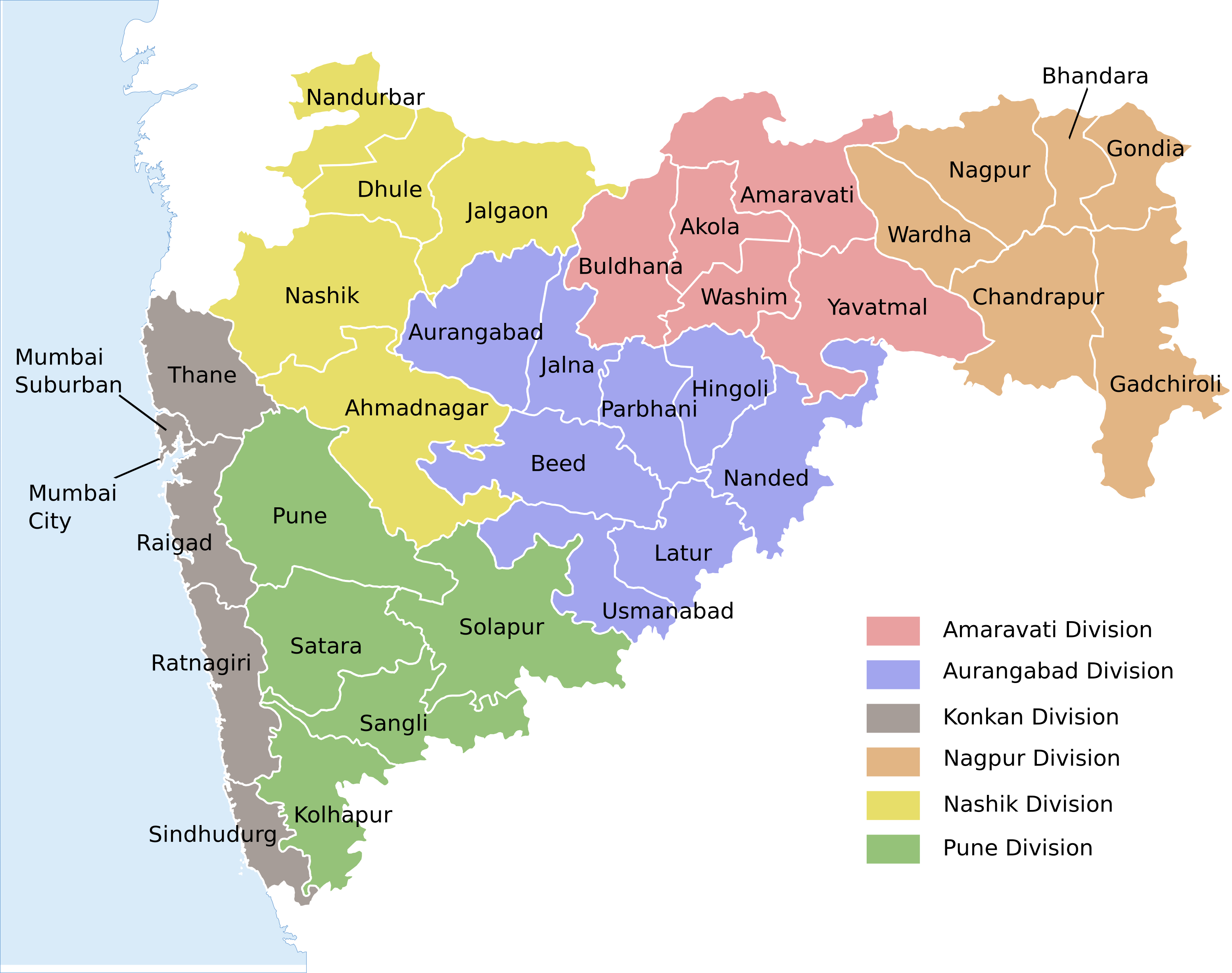
Download the districtwise shapefiles by clicking on the map above or on the district name below .One can open the downloaded shapefiles with the help of any GIS(e.g.QGIS) tool.
Download QGIS (Free and Open Source) from :- QGIS (https://www.qgis.org/en/site/forusers/download)
Each shapefile contains 600+ (click here for explanation of field name shortforms) attributes for each village of the district.
Note:-
1)The map contains some gaps because we were unable to get proper geometries for the same.
2)List of missing villages (for which we do not have geometry information) is given here:-List
3)MumbaiCity and MumbaiSuburb data are not included as corresponding geometry data was not availaible.
4)We are trying to update above map as much as possible.All help is welcomed.
Part of Department of Computer Science and Engineering, Indian Institute of Technology Bombay, Powai, Mumbai 400 076
Main office : Kanwal Rekhi Building. Tel: +91-22-2576 7901/02. Fax: +91-22-2572 0022